 |
| Technique: |
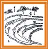
TERRACING SYSTEMS |
| Local name: |
La Ciudad Perdida, Sierra Nevada de Santa Marta, COLOMBIA |
| Site: |
La Ciudad Perdida, Sierra Nevada de Santa Marta, COLOMBIA |
|
Location

Click the globe to see the techinique on Google Map
|
Continent: South America
Country: Colombia
Site: La Ciudad Perdida, Sierra Nevada da Santa Marta
Coordinates:
Lat:
11.03
Long:
-73.92 |
Description of the local variant of the technique
The ruins of the Ciudad Perdida, situated on the northern slope of the Sierra Nevada de Santa Marta, were discovered by J. Alden Mason during his expeditions of1922-23. Today the Ciudad Pedidida is a National Monument. The ruins of this ancient settlement are grouped on a bank of the Buritaca river. Here, beginning from the 11th century the native community of the Tairona built one of the most important cities from the point of view of adaptation to a hostile environment, characterized by a steep terrain and heavy rainfalls: it rains almost all year round and rainfall levels range from 2,000 up to 4,000 mm per year, with temperatures spanning from 17 ° to 24 ° C. The site covers an area of 20 hectares and it is surrounded by various waterways. The ruins are located between 900 and 1,200 meters above sea level, on 169 terraces, with their containment walls which rest on the profile of the mountain, with paths, stairs and channels, made of stone, intertwined with green areas . The terraces forming the Ciudad Perdida follow the "ridge" of the mountain, forming what was called the central axis where the buildings of the political and religious power were located. The terraces were built to obtain a greater level surface. On both sides of the slope there are terraces which served as the basis for the construction of houses. Today we see the rings of stone that formed the foundations of buildings, with an area ranging from a minimum of 6 to a maximum of 200 square meters. There are some semi-circular buildings, probably used as warehouse, located in the suburbs. While along the main axis the remains of rectangular buildings of large dimensions were found.
The terraces
Of great importance are the containment walls made of slabs of stone held together by rectangular or rounded rocks, called "tensors" whose function was to support the load of the wall. The native Koguis called them sandinkamas, which means "Guardians of the wall." The construction technique employed in the building of terraces consisted in cutting the slope vertically in the shape of hooves, which were filled with the resulting material, and supported on the opposite side to that of the slope by sophisticated walls. The containment walls vary depending on the slope. In addition to the terraces, the walls were also used as paths and drains for rainwater. In the construction of the walls no cohesive material was used, but only selected clays. In the upper parts, permeable clays were used in order to facilitate the penetration of water into the lower parts.
The canals
The Ciudad Perdida presents remarkable canal works, with which it was possibile to control the flow of rainwater thus avoiding erosion and the washing away of materials. We observe smooth parts, lined with stones which had the function of avoiding the accumulation of mud.
Footpaths
Another very interesting aspect of Tairona settlements are the paths, which extended to the coast, linking the various provinces. In Ciudad Perdida, the path of the central axis has a complex structure, which in some places reaches a thickness of 0.6 m and a width of 2 m. There are also simple paths, consisting of unfashioned stones. Both the main and secondary routes are built with stone slabs of various sizes and in some places some large stones called "retirement plans" are found which have various functions, including that of mitigating the force of rainwater. Some stones presents some of the cuts and served as benchmarks by
Survival prospects
Dead technique
Images


Deepening
 DRY STONE WALLS
 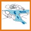 WATER INTAKES AND CHANNELS
  WATER MANAGEMENT ON TERRACED FIELDS
