LOCAL APPLICATION OF THE TECHNIQUE SUNKEN DAMS 13
Jump to navigation
Jump to search
| LOCAL APPLICATION OF THE TECHNIQUE | ||||||||||||||||||||||||||||||||
|
||||||||||||||||||||||||||||||||


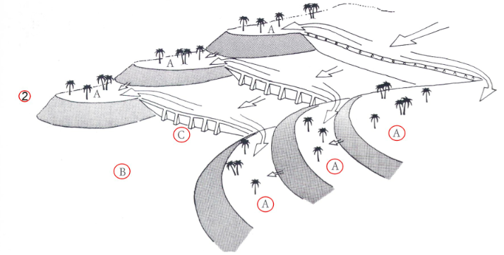
 DIVERSION SYSTEMS ON A LARGE SCALE AND USE OF FLOODS
  ROCKER ARMS WELLS
  TECHNIQUE OF SOIL IRRIGATION
  TERRACING SYSTEMS
  WADI OASES
  WATER CORPORATION AND HYDRAULIC LAW
